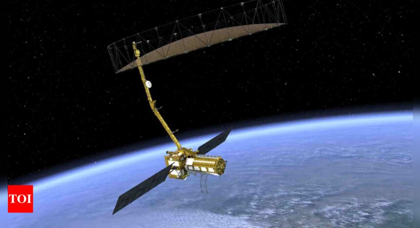
After several delays, NASA has revealed that the highly anticipated NISAR satellite, developed in collaboration with ISRO, is now expected to launch in March 2025. Initially scheduled for 2024, the satellite is poised to become the most advanced and costly Earth observation system in the world.
NISAR stands for NASA-ISRO Synthetic Aperture Radar. This satellite will monitor nearly all land and ice surfaces on Earth every 12 days, capturing essential data on changes in ecosystems, land and sea ice, and geological activity. It will be launched from the Satish Dhawan Space Centre located on India’s southeastern coast.
Weighing 2.8 tonnes, the NISAR satellite has been in development since the signing of a bilateral agreement between India and the United States in 2014. It is designed for high-precision monitoring of planetary changes, employing cutting-edge technology that includes dual-frequency radar. NASA’s L-band (1.25 GHz) and ISRO’s S-band (3.20 GHz) will enable the satellite to deliver exceptional data accuracy. In October 2024, major components of the satellite were successfully transported from the US to India, a significant logistical achievement. However, the mission has faced delays, primarily due to technical challenges with its 12-meter radar antenna.
The data collected by NISAR will be invaluable in helping manage natural resources and assessing hazards. It will furnish scientists with insights essential for understanding climate change and its impact. Furthermore, the satellite’s observations are expected to elucidate Earth’s solid crust, monitor changes in glaciers, ice sheets, forests, and wetland ecosystems, and track geological movements such as earthquakes, landslides, and volcanic activity.
With its expansive and rapid coverage, NISAR will offer substantial prospects for disaster response, supplying data essential for damage assessment and mitigation in the aftermath of disasters. Its capabilities include high-resolution imaging through radio signals, performance in darkness and adverse weather conditions, the detection of surface changes as minor as one inch, and the ability to penetrate thick vegetation for comprehensive mapping.


